
Ahmet Y.
Fullstack React+Node.js developer

Ahmet is a fullstack developer with more than 4,5 years of experience in the field. He is proficient with Javascript, React and Node.js. He likes to learn new things in his job and outside his career.
Skills
- Javascript
- React
- Node.js
- HTML
- CSS
Experience
Informational technologies and services, Turkey
Software Engineer
August 2018 to Present
Stack:
- React
- Node.js
- Angular
- Javascript
- Jenkins
- Docker
- Nginx
- Openlayers
- PostgreSQL
Responsibilities:
- Maintained all projects related to the Geographic Information System (GIS Software).
- Some of the projects have Jenkins pipeline to provide the CI/CD operations. These applications are dockerized and docker swarm is used. We use ansible with Jenkins to deploy production and test servers.
- We use Geoserver to provide Map services (like Wms, Wfs) from GIS database.
- Nginx is used as a reverse proxy with certbot. We use Openlayers or CesiumJS to show a map on a browser.
Education
Computer Engineer, Trakya University
September 2013 to August 2017
Turkey
Portfolio
Postgres is used as a database to store geospatial data with Postgis extension.
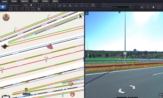
The application is like a digitization tool that you can add any inventory in a roadway. There is a car that has 360°camera, a lidar for the ground, a lidar for around, 2 GPS devices. Turkey’s entire roadways are recorded via these cars. It has over 500Terabyte of data on the production server.
I was in the frontend and backend teams. I did not contribute for a year at 2020. Then I came back in early 2021.
This project was the biggest project that the company developed. So it still gets updated. It will get updated at least until August 2022.
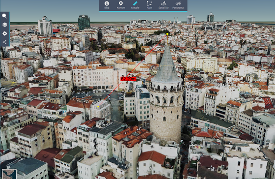
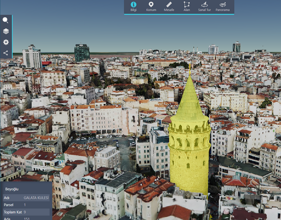
The application has a panel that you can add a database as a store then you can publish a layer from a database’s table as a 3D layer(PointZ, PolygonZ). You can publish a dynamic-floor layer if the table of polygon has a floor count column. Otherwise, you need to set a static value.
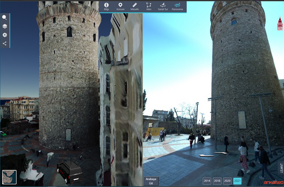
You can right-click to open 360° camera for the same position.
I still (2021) add some minor features and make a new demo app for potential customers.
Request Ahmet's Rate
Find us on:
